About the Clackamas River
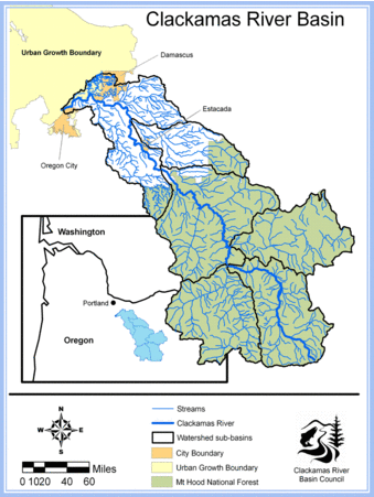
The Clackamas River originates on the western slopes of Olallie Butte, a 6,000′ cascade volcano in the Mt. Hood National Forest. From there, it flows 82.7 miles to it’s confluece with the Willamette River in Gladstone and Oregon City. The river winds near Government Camp and through several communities including Estacada, Eagle Creek, Carver and Happy Valley. It also passes through three hydropower dams and hundreds of private residences.
Wild & Scenic River
47 miles of the Clackamas River are designated as Wild & Scenic by the National Wild & Scenic River System. You can visit this section of the river between Big Spring (headwaters area) to Big Cliff, just south of the town of Estacada. Within this section of the river, you will see picturesque views with forests, wetlands, rock cliffs, and wildlife.
In order for a river to become a National Wild and Scenic River, it must have at least one resource that is considered to be “outstandingly remarkable.” Assessment of the Clackamas River found five different resource categories to be “outstandingly remarkable” — recreation, fish, wildlife, historic, and vegetation.
Home to Sensitive Species
The Clackamas watershed is a special place. It is home to the last significant run of wild late winter coho in the Columbia Basin, and it is also one of only two remaining runs of spring Chinook in the Willamette Basin. In addition, it supports a significant population of winter steelhead. The watershed is also home to threatened and endangered species, including the peregrine falcon, bald eagle, and Nelson’s checkermallow.
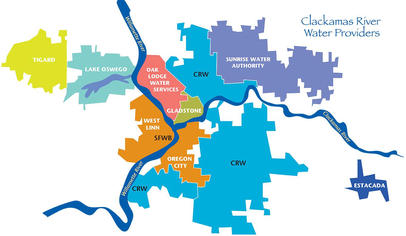
Does Your Drinking Water Come from the Clackamas?
if you live in Estacada, Oregon City, Happy Valley, Gladstone, Oak Lodge, West Linn, Lake Oswego and Tigard – the water that comes out of your tap comes from the Clackamas River. It supplies clean drinking water to over 300,000 Oregonians – or 10% of the state.